from 0 review
13 nights 14 days
Daily Tour
20 people
English, Hindi
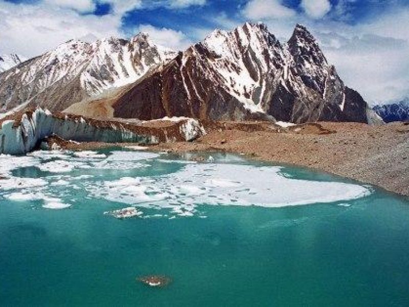
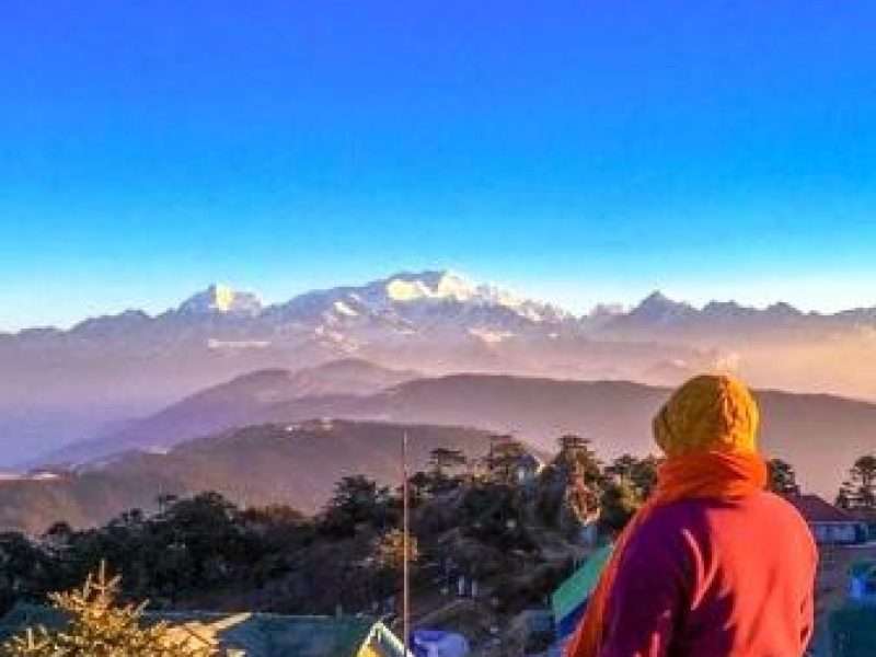
An expedition to the Annapurna Circuit is a journey of a lifetime. The combination of rugged mountain massifs, sparkling streams and rivers, ancient temples and the breathtaking landscapes and views at every turn make this an incredible adventure.
To reach the start of the trek there is a long drive, first down the main Pokhara road then following the Marshyangdi river to Besi Sahar. The trek proper begins here, crossing and recrossing the gorge carved by the Marshyangdi river on suspension bridges before you reach Manang, the largest village on the route.
An acclimatisation day is taken here to prepare for crossing the Thorung La pass which is the highest point of the trek at 5416m. From there you descend progressively with plenty of up and down along the way until you reach Jomsom or if you have time complete the full circuit by trekking to Birethanti.
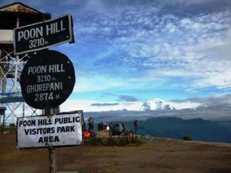
We offer two itineraries, a 14 day version flying back from Jomsom for those short on time or, for those who have plenty of time, the full 18 day circuit trekking all the way out to Birethanti, including an ascent of Poon Hill, one of the best panoramic viewpoints in the Himalaya.
Additional days relaxing on the shores of Lake Pokhara can be arranged before you fly back to Kathmandu.
Our representative and driver will meet you at the airport and take you to your hotel. The representative will help you check into your hotel. At the hotel you will meet your guide and be briefed about your daily activities.
You begin this trip driving along the Kathmandu-Pokhara Highway to Dumre and then following the rough route by the Marshyangdi River. After 6 hours you finally reach Besi Sahar, the capital of Lamjung District. From here you start your trek to Bhulbule, climbing up towards the village of Denauti where you will see Nepali village life at close quarters until you reach the village of Bhulbule.
Today you walk northwards away from Bhulbule, and further into the deep gorges of the Marshyandi Valley towards the village of Syange where you will see Nepali village life at close quarters. You get to see the Annapurna range clearly for the first time. The trail crosses a suspension bridge and follows terraced rice fields, offering great views of Manaslu. As the trail goes uphill, you spot several shops and teahouses at Ngadi village. On leaving Ngadi, trek to Bahundanda which literally means "Brahmin Hill" and as the name suggests Bahundanda is largely inhabited by Brahmins. A steep trail descends from Bahundanda before crossing a stream. It then climbs again and traverses the hillside before reaching the village of Hani Gaon. You follow the winding mountain path down through Syange and along the river for some distance. The trail then climbs steeply and the path is cut into the sheer cliff-face some 200-300m above the river-bed. Eventually you descend to the stone village of Jagat, situated on a shelf, which juts out into the Marshyangdi valley.
The trail from Jagat descends until it reaches the river and then continues through a lush forest, before ascending to a sharp-edged cliff facing the riverbank. After crossing a suspension bridge, you climb steeply on the path to Sattale and then to Tal. As you walk away from Tal, the path becomes rugged and winding and you pass the forested village of Karte and Dharapani before you finally reach Bagarchap.
You skirt through a narrow field from the village. The Dudh Khola, which originates from the south face of Manaslu before joining the Marshyangdi, veers to the left. Annapurna II becomes visible as you arrive at Bagarchhap, a Bhotia village with colourful prayer flags. As you continue ascending through forests of pine and oak, you pass through Dhanakyu before coming to a large waterfall. Further on, the Marshyangdi river enters a gorge and the trails follows a rock-strewn path. When the steep incline ends, you follow a path amid rhododendrons and continue on a gently rising path. You cross a stream before entering a pine forest. You then enter the hamlet of Kotho, from where you can get a good view of Annapurna II. The route reaches a large white gate with a corrugated iron roof, which is the entrance of Chame, the administrative headquarters of Manang district. There is electricity, a wireless station, schools, shops, health post, post office, police check post, hotels, lodges and banks in Chame. The hot springs are a major attraction too.
Today you head off for Pisang crossing a large suspension bridge over the Marshyangdi. Your trail meanders through fields leading to Teleku at 2775 metres before reaching Bratang. After leaving the forested village, the valley changes from a V-shape to a gentle U-shape. Further on, you continue up steep trails to the south side and cross a long suspension bridge at 3040 metres. From here you get to view Paungda Danda rising more than 1500 metres from the river. You cross one final bridge and enter the village of Pisang.
You start today heading along a steep ridge with wonderful views of the Manang valley and Tilicho peak. You descend through Manang's airstrip to come to Hongde, lying beneath Annapurna III on the north-east face. The route then leads to the wide plain of the Sabje Khola Valley from where you get views of Annapurna IV (7525m). Further on, you cross a wooden bridge, and enter the village of Mungji. You continue along the cultivated fields and after a while arrive at the village of Bryaga which has a lovely monastery. On trekking down to Manang, you get more views of the Annapurna range - Annapurna II, Annapurna III, Annapurna IV, Gangapurna (7455m) and Tilicho Peak (7134m).
Today you will do two acclimatization treks upper to higher altitude to visit a local stupa and also an spectacular view point to help you to prepare for climbing higher tomorrow. You will also have time to enjoy a Lavazza coffee and tuck in to a cinnamon danish or chocolate croissant baked locally.
Leaving Manang you cross a stream and climb to Tengi, 120 meters above Manang, before leaving the Marshyangdi Valley to head up the valley of the Thorung Khola. The vegetation of scrub juniper and alpine grasses marks the climb in altitude as you reach the small village of Gunsang, a cluster of flat mud roofs just below the trail at 3960 meters. The trail takes you further along a large stream that flows from Chulu Youst and Gundang and leads to Letdar.
Leaving Letdar, you climb gradually to a ridge before descending to the headwaters of the stream and crossing via a covered wooden bridge. After a short ascent up the mountain path on the right bank, you follow a narrow trail across an unstable steep slope and then descend to Thorung Phedi. You will take a short break here before climbing up steeply a further 300 metres to Thorung High Camp. Tonight you will make your final preparations for an early ascent tomorrow of the Thorung La Pass.
You have an early start today for the crossing of Thorung La Pass(5416m). The trail starts off steadily zig-zagging its' way up the mountainside. The gradient then eases and after around 1 1/2 - 2 hours of steady climbing, you reach the prayer flags of the pass. From the snow-covered mountains above, to the head of the Kali Gandaki valley below and the brown and purple hills of Mustang, which spread out before you, you are presented with dramatic views in every direction. The descent to Muktinath is a tough 1600m but the excellent views of Dhaulagiri are a good distraction. Eventually moraine gives way to grassy slopes before a pleasant walk along the Jhong Khola Valley to Muktinath, with its shrines and temple.
You now begin the descent down the dramatic Kali Gandaki valley, initially through arid country in the same geographical and climatic zone as Tibet. After passing through Jharkot and Khingar, villages with typical Tibetan architecture, you follow the valley floor most of the way to Jomsom. En route, you get tremendous views of both Dhaulagiri and Nilgiri. Jomsom is a large town sprawled along both banks of the Kali Gandaki River, and it is here you will spend the final night of your trek. (walk approx 3 hours)
You take an early morning flight from Jomsom to Pokhara. It is a spectacular flight along the Kali Gandaki Gorge and provides wonderful views of both the Dhaulagiri and Annapurna ranges. You then catch a further flight back to Kathmandu.
Our representative will take you back to the airport for your flight home.

Leave a reply